































1 minute
Innovative Smartphone Partnership Fights Polio in Northern Nigeria
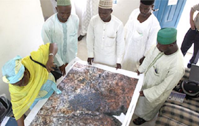
This article describes a public-private partnership to fight polio in Nigeria that harnesses the power of smartphones to monitor real-time performance of vaccination teams during door-to-door campaigns. Using global positioning system (GPS) data, a specially designed android application helps map the location of communities in high-risk areas for polio and enables monitoring of the quality and coverage of campaigns in real-time. The initiative emerges from a collaboration between the Global Polio Eradication Initiative (GPEI), the Economic and Social Research Institute (ESRI), and telecommunications service provider Etisalat. Funding is provided by the Bill & Melinda Gates Foundation.
With GPS transmitters attached to vaccine carriers, the software tracks the daily progress of vaccinators, uploading their routes to the ESRI ArcGIS server. Maps are then generated showing which areas have been successfully covered, highlighting where the risk of polio transmission still remains. These "risk maps" and reports provide real-time micro-planning data for polio teams, programme managers, and communities, hopefully helping them make immediate adjustments to make sure they reach - and vaccinate - more children in Nigeria, which accounts for 55% of the polio cases worldwide.
Polio News [PDF], July 2012. Image credit: (c) UNICEF/2012/L. Andriamasinoro